

High-performance geospatial solutions for surveying
and mapping
Trimble sets the benchmark for geospatial technology through integrated field-to-office solutions that prioritize accuracy and efficiency.

Precision surveying
Experience the confidence of high-accuracy, high-quality results across every application. Trimble technology is engineered for every day, providing the reliability needed to handle your most demanding field tasks.
Streamlined field-to-office workflows
Eliminate data silos with powerful geospatial solutions that connect the field and office. Our integrated systems reduce errors and ensure a seamless exchange of data, allowing for real-time collaboration and faster decision-making.
Increased productivity and ROI
Designed to help surveyors work faster and safer, Trimble solutions are a smart investment for your fleet. By reducing rework and streamlining processes, you save your company significant time and money.
Proven, reliable durability
Trimble instruments are engineered to withstand the toughest environments. Trusted by professionals worldwide, our hardware is built for longevity and consistent performance in any condition.
Expert support and guidance
With a global network of dealers and experts, you have access to live product demonstrations and technical training. We ensure you have the right configuration and knowledge to get the most out of your workflow.
See how high-performance technology improves real-world field results.
Trusted by surveyors worldwide


Choose the right Trimble solution for your workflow
Trimble offers a comprehensive portfolio of trusted geospatial hardware and software solutions that meet specific project requirements, from land surveying tasks to high-speed 3D capture.
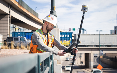
GNSS systems
Achieve high-precision positioning with robust satellite tracking and correction services combined with advanced technology that combats jamming, spoofing and ionospheric scintillation.
Ideal for: Topographic surveying, land boundary identification and construction site positioning.
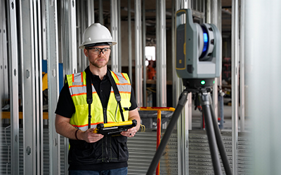
3D reality capture
Capture millions of points and georeferenced images to create high-fidelity digital twins of complex environments.
Ideal for: Digital twin and as-built documentation, large scale asset mapping
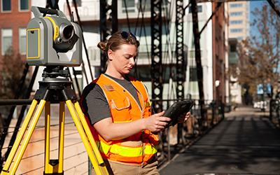
Total stations and optical instruments
Total stations are engineered for fast, silent and ultra-precise control. From mechanical to robotic and scanning total stations, these systems reduce rework and deliver confident results.
Ideal for: High-accuracy survey work, long-range robotic operation and boundary or structural monitoring
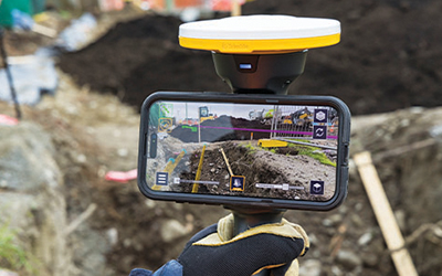
Augmented reality
Overlay 3D models onto the real world using geospatial augmented reality. This allows crews to "see" hidden infrastructure or visualize future construction progress in real-time.
Ideal for: Construction reality capture and utility mapping, construction and infrastructure inspection
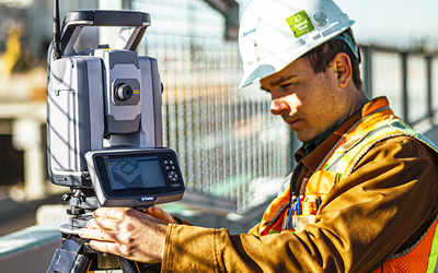
Geotechnical and structural monitoring
Monitor movement and stability with high-precision sensors and automated software. Ensure safety and compliance on critical infrastructure projects with reliable, 24/7 data.
Ideal for: Dam and mining monitoring, tunneling and bridge stability
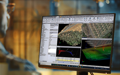
Field and office software
Simplify data capture with an intuitive field-to-office workflow. Designed for maximum accuracy, our office software seamlessly integrates with field sensors to power your most demanding projects.
Ideal for: General surveying, mapping and field-to-office data sync

Experience Trimble solutions today
Trimble geospatial solutions help you work smarter across every phase of your project. Our local dealers are ready to provide the expertise you need to upgrade your fleet or optimize your workflows.
Our global distribution partners provide:
- Live product demonstrations
- Expert guidance on cost and configuration to ensure you select the hardware and software solutions best suited to your applications
- Training to get the most out of your solution and your workflows
Contact us now
Fill out the form to get in touch with a local Trimble dealer.
|
|

Trimble Inc. and Affiliates
10368 Westmoor Dr. Westminster, CO 80021


Terms of Use Privacy Statement Trademark Information Do Not Sell My Personal Information ©2026, Trimble Inc. and Affiliates